Wyoming State Historic Preservation Office
Historic Context
Wyoming Homesteading, Ranching, and Farming: 1860-1960

Home> Wyoming Historical Maps
Wyoming Historical Maps
Historical maps can be of great value not only for identifying particular places that may not appear on current, popular maps, but also in showing population trends (reflected in county formation), the development of transportation systems, and the creation (and demise) of small towns and villages.
The following maps dating from the mid-1880s to 1909 are useful references and sources themselves. In addition, for more maps, be sure to consult the Historical Maps of Wyoming in the Wyoming State Archives Online Map Collection at http://wyoarchives.state.wy.us/Archives/Maps.aspx
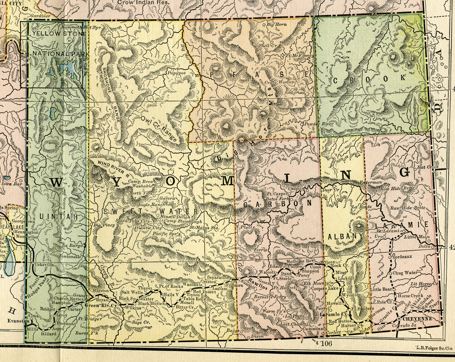 |
Wyoming Territory, about 1882 Detail from map of Montana, Idaho, and Wyoming in People's Cyclopedia of Universal Knowledge (New York: Phillips & Hunt, 1882). Map from collection of Michael Cassity. |
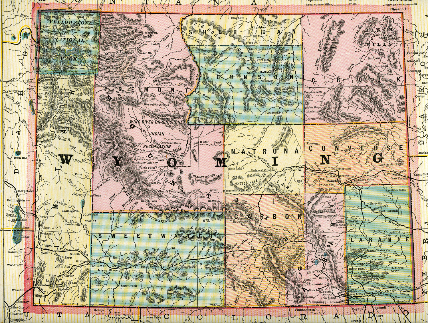 |
Wyoming - 1887 Cram’s Unrivaled Atlas of the World (Chicago: George F. Cram, 1887). From collection of Michael Cassity. |
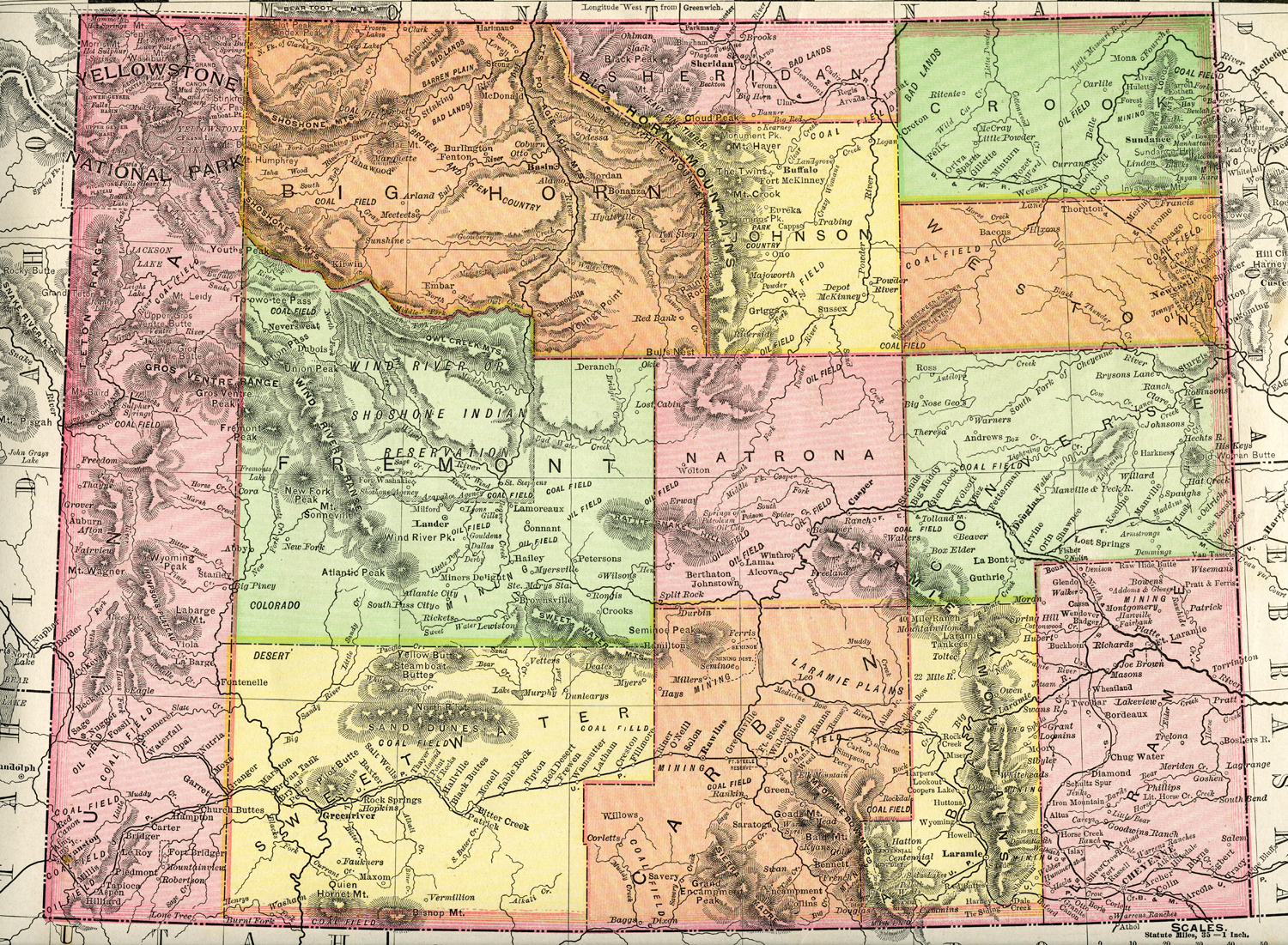 |
Wyoming - 1895 Rand, McNally Atlas of the World (Chicago: Rand McNally, 1895). From collection of Michael Cassity. |
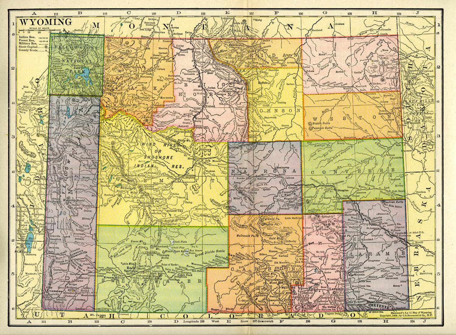 |
Wyoming - 1909 Hammond’s 8 x 11 Map of Wyoming, (New York: C. S. Hammond & Co., 1909). From collection of Michael Cassity. |
 |
Wyoming - 1921 The New World Atlas and Gazetteer (New York: P. F. Collier, 1921). From collection of Michael Cassity. |